
Most of us see clouds every day, but only very occasionally will you be lucky enough to spot one of these 7 particularly rare types – some of which can only be seen in very specific circumstances or locations. But what is the rarest cloud type?
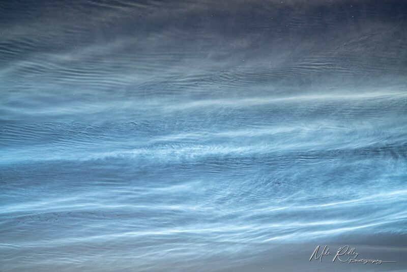
Noctilucent clouds
Noctilucent Clouds are one of the rarest and most beautiful of all cloud types. They are found at very high altitudes – up to around 250,000 feet Visible on clear, summers nights between 45 °N and 80°N latitude ,they appear illuminated by a blue or occasionally red or green light. We still do not know much about how they are formed, but they are thought to be made up of ice crystals.
Kelvin-Helmholtz clouds
They can sometimes be seen as far as 60 miles downwind of the mountains that formed them. An extremely rare phenomenon, where clouds form as a billowing wave pattern Occurs when there is a strong vertical shear between two air streams. This causes some winds to blow faster at the upper level, than at the lower level.
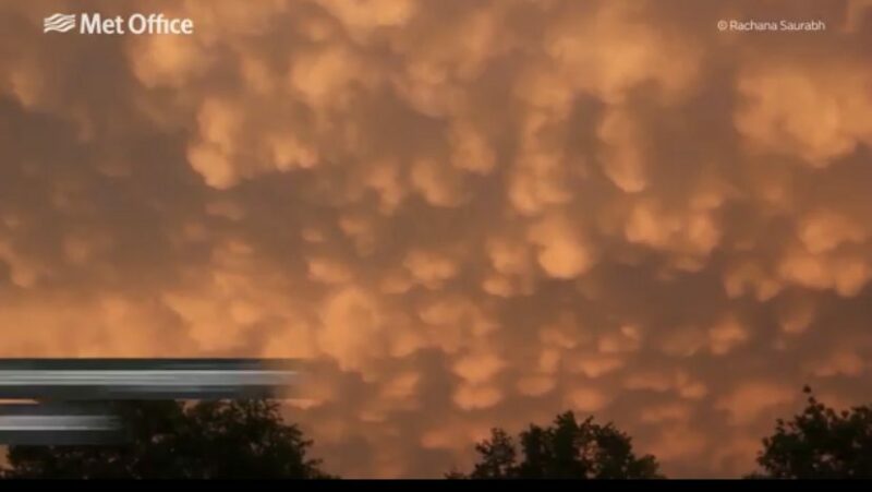
Mammatus clouds
Bulge or pouch shaped, Mammatus Clouds are usually seen emerging from the anvil at the top of cumulonimbus clouds. Formed by turbulence, they are one of the few clouds that come from sinking, rather than rising air.
Lenticular clouds
Usually formed behind hills or mountains, where the air is stable and winds are blowing from a similar direction. These tall geographic features interrupt the wind, the airflow undulates and condenses into these disc shaped clouds.
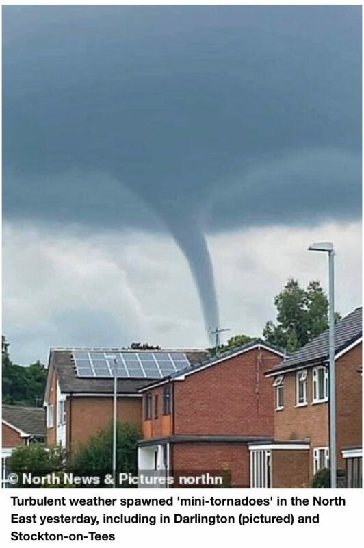
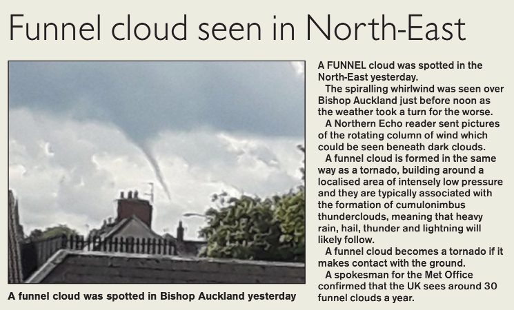
Funnel clouds
Cone shaped clouds which extend from the cloud base, but never actually touch the ground. Formed in the same way as a tornado around a small area of intensely low pressure. If a funnel cloud reaches the land it becomes a fully fledged tornado and if the funnel cloud reaches the surface of a body of water, it becomes a waterspout.
Fallstreak Hole clouds
Also known as a hole punch cloud – they form when part of the cloud layer turns to ice crystals which are large enough to fall. Water droplets in the cloud, cooled below 0°C but not yet frozen, will freeze if they find a particle to freeze on to or are cooled to below -40°C. Aircraft can cause this to happen by making the air expand & cool as it passes through the cloud
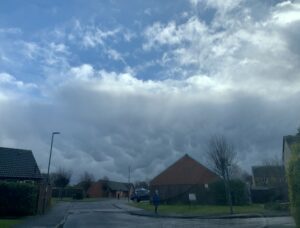
Arcus cloud
Formed when warm air within a storm cloud is pushed up from the ground by the cold air exiting downwards. Unattached to the storm cloud they are known as roll clouds, but when attached they are called shelf clouds.
Latest Cloud Posts
- Mammatus Cloud in Durham on 6th February 2022
 The following was observed just after the passage of a very potent shower on 6th February 2022. The ‘cows udder’ appearance of Mammatus Cloud is due to intense updraughts in … Read more
 - Tornado (Funnel Cloud) over Darlington 10th July 2021There was a lot of hot but turbulent weather early in July 2021 which spawned some thunderstorms and funnel clouds in places. Funnel clouds and tornadoes are rare in the … Read more
- 7 Rare clouds types | Amazing WeatherMost of us see clouds every day, but only very occasionally will you be lucky enough to spot one of these 7 particularly rare types – some of which can … Read more
- Noctilucent Cloud Display over Durham June 2019Noctilucent Clouds over Durham City, June 17th/18th 2019 by Mike Ridley Photography Some of you eagle-eyed skywatchers will have noticed a ghostly glow in the sky on the way back … Read more
- Funnel Cloud seen over North East England – 28th May 2019The report above appeared in the Northern Echo newspaper on 29th May 2019. The axis of funnel clouds may be vertical, inclined (as seen here), or sometimes long and sinuous. … Read more
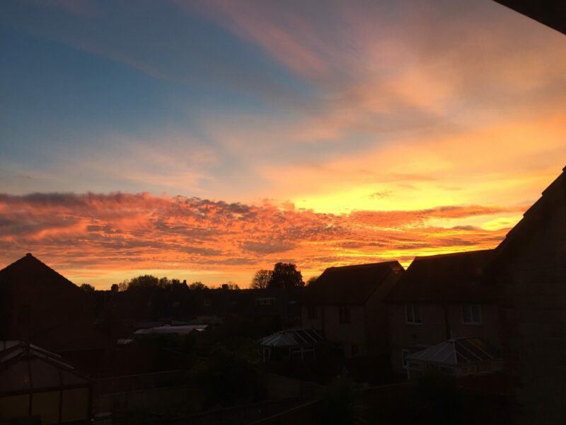
- Fantastic Sunset over Durham tonight – 24th Oct 2018The sky turned red over Durham tonight as the sun dipped toward the horizon. No words needed really, it speaks for itself. Sunset over Gilesgate, Durham in October 2018 Latest … Read more